A late‑season winter storm system is expected to bring heavy snow and “hazardous” travel conditions to some parts of Colorado and New Mexico, particularly across mountainous regions, prompting multiple winter storm warnings on Thursday that are set to last until Friday, according to the National Weather Service (NWS).
Separately, the NWS has issued a winter weather advisory to parts of Alaska through Thursday morning, forecasting blowing snow and reduced visibility in high‑elevation areas.
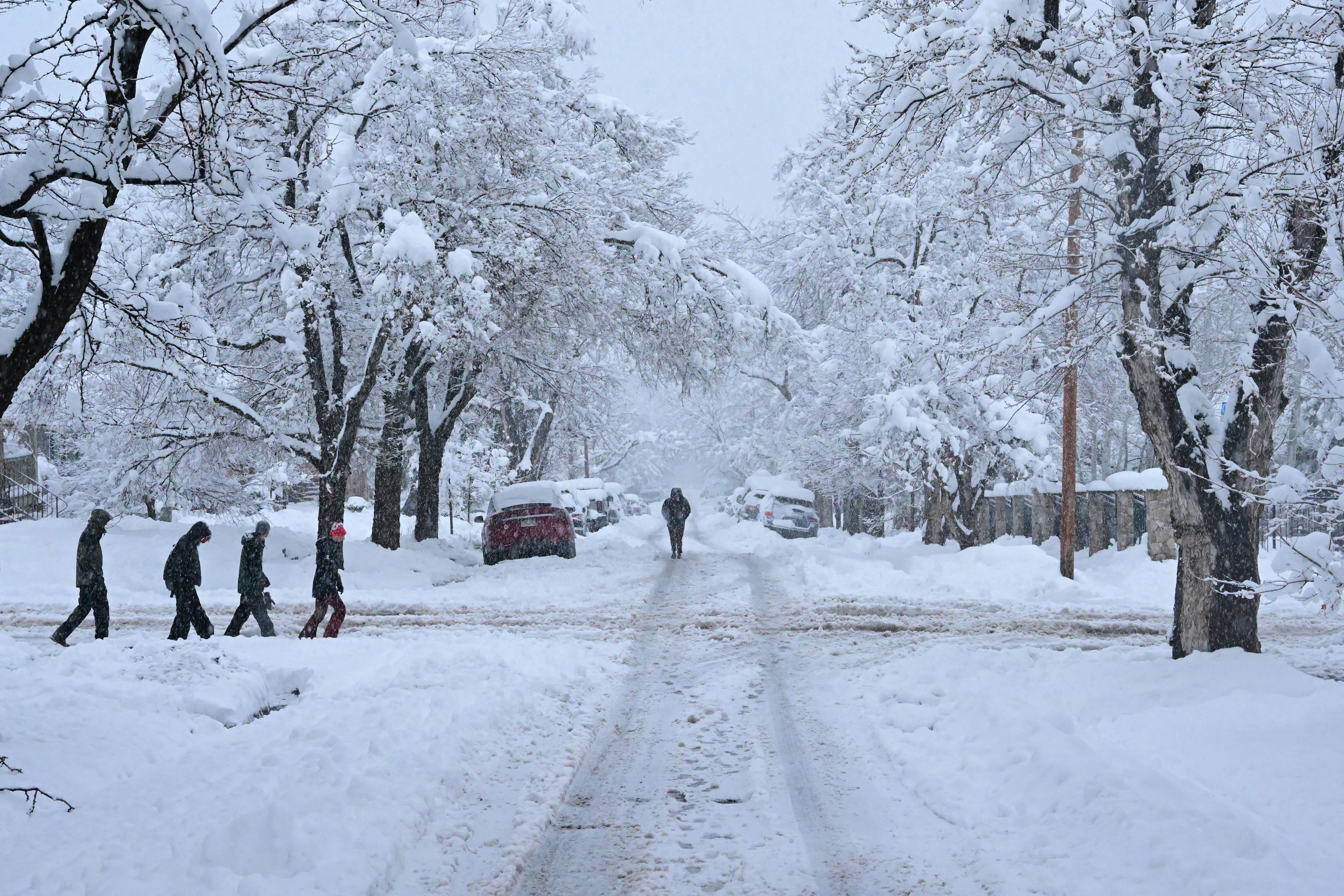
NWS forecasters warn that the combination of heavy snowfall, fluctuating snow levels and difficult road conditions is likely to disrupt travel—especially across higher elevations, including popular mountain passes and corridors—affecting commuters, commercial traffic and outdoor activities.
Heavy Snow Targets Colorado
In southern and central Colorado, winter storm warnings are in effect for parts of the Sangre de Cristo Mountains, Wet Mountains, Teller County, Rampart Range and Pikes Peak. These areas are forecast to receive anywhere from 8 to 16 inches of snow, with the highest amounts falling across the higher, east‑facing slopes, according to the NWS office in Pueblo.
At the same time, winter weather advisories are in place for additional locations in central and north-central Colorado, spanning the Mosquito Range to Rocky Mountain National Park. These areas could see between 5 and 13 inches of snow—with more likely over higher elevations—while lower valley areas, such as the Wet Mountain Valley, may get between 3 and 7 inches.
Snowfall is expected to begin early Thursday morning and continue through Friday, with the most hazardous travel conditions likely to be on Thursday evening into Friday morning.
The NWS cautioned that mountain passes—including La Veta Pass, Poncha Pass, Berthoud Pass and the Eisenhower Tunnel—could experience wet, slushy and snow-covered roads, making driving slow and potentially dangerous.
New Mexico Should Prepare for Heavy Snowfall
Further south, northern New Mexico faces its own winter storm warning, covering the Sangre de Cristo Mountains and Raton Pass, where snow levels are expected to reach up to 14 inches—especially in areas near 10,000 feet—from Thursday afternoon until Friday night. The snowfall is expected to affect travel across mountain highways, and tire chains are recommended. The NWS said the heaviest snow was likely to be through Thursday night into Friday morning.
Alaska Advisory Highlights ‘Blowing Snow’ Risks
Meanwhile, in northern Alaska, a winter weather advisory remains in effect for the central Brooks Range, including Atigun Pass along the Dalton Highway. Additional snow accumulations of up to 3 inches, combined with wind gusts reaching about 30 mph, could create periods of blowing snow, which might reduce visibility to less than half a mile at times.
How Heavy Snow Affects Daily Life
Heavy mountain snowfall can affect more than road travel. Wet, dense snow increases the risk of vehicle accidents, road closures, delayed emergency response times and power outages, particularly when snow accumulates rapidly.
In higher terrain, changing snow levels can also heighten avalanche danger and complicate backcountry travel.
How To Prepare Before and After the Winter Storms
The NWS is urging residents and travelers in affected areas to prepare for the possibility of heavy snowfall ahead of time, especially in mountainous regions.
Before the storm, residents should consider the following:
- Check local road conditions by either calling 511 or monitoring official Department of Transportation websites.
- Avoid nonessential travel, particularly over mountain passes.
- Stock vehicles with emergency kits, including shovels, nonperishable food, drinking water, blankets, flashlights (with spare batteries) and extra clothes.
After the storm, residents should consider the following:
- Allow extra time for crews to clear the roads.
- Watch out for black ice and compacted snow, even after the snowfall ends.
- Clear snow from walkways and roofs to reduce the risk of injury.
- Monitor updated forecasts, as additional advisories or warnings may follow.
With winter conditions lingering into late April and early May, forecasters stress that mountain weather can change rapidly, even as lower elevations experience springlike conditions.
Is More Snow Expected for Colorado, New Mexico and Alaska?
The NWS warns that while conditions will dry out briefly on Saturday, parts of Colorado could see additional rain and snow showers beginning on Sunday and continuing into next week—particularly at higher elevations—as temperatures begin to cool midweek.
For New Mexico, the NWS isn’t forecasting any additional snow after Friday, as temperatures remain warm. Any precipitation midweek is likely to fall as rain, even in higher‑elevation areas.
Alaska, however, faces a different outlook. The NWS says the state could see multiple chances for rain and snow until at least Tuesday, particularly overnight and at higher elevations, where temperatures hover at near freezing.
Related Articles