Since the U.S. and Israel launched attacks against Iran in late February, Chinese satellite imagery of the conflict zone has proliferated—potentially offering battlefield guidance to Tehran and other U.S. adversaries.
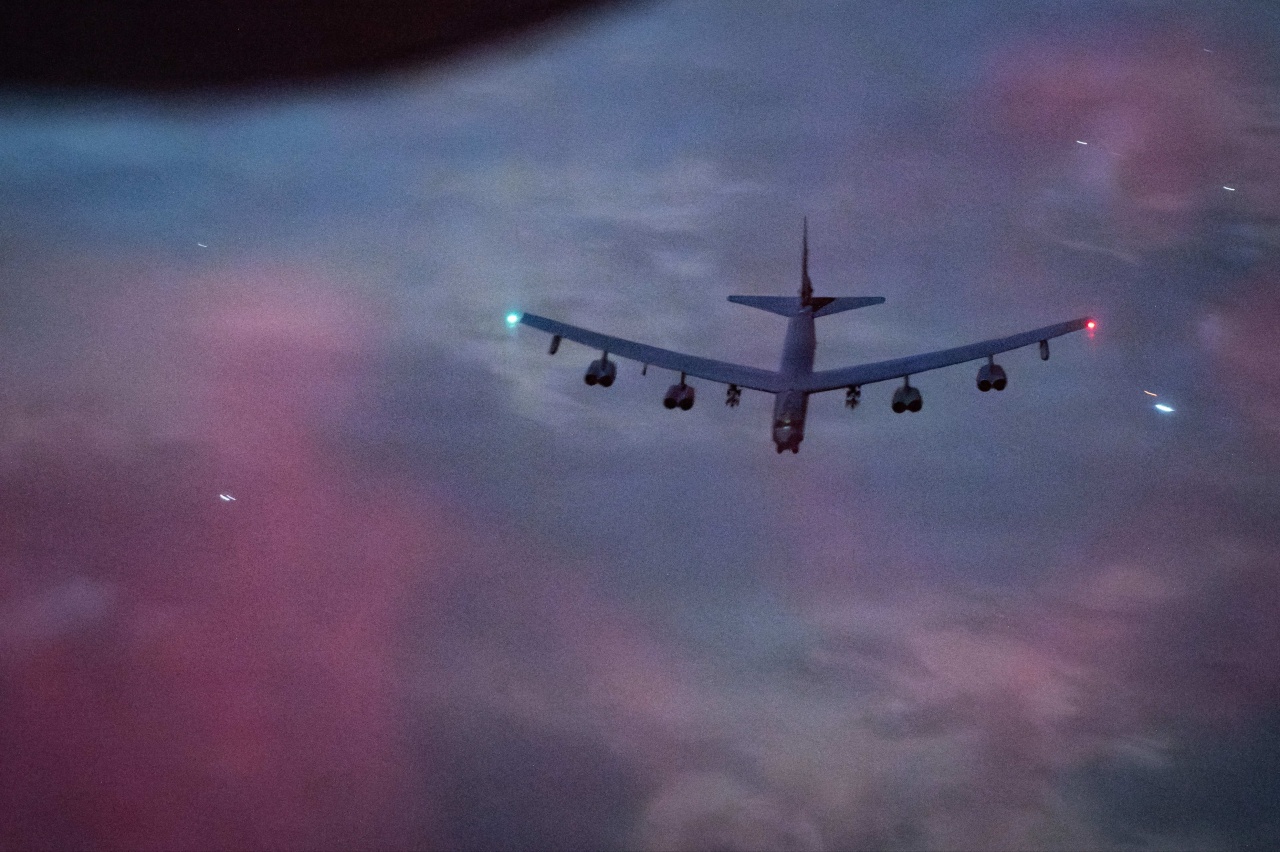
U.S. concerns about the use of such data in the Middle East grew after the Chinese artificial-intelligence company MizarVision claimed on social media to have tracked the movements of American aircraft carriers, F-22 stealth fighters and B-52 bombers by using AI to analyze satellite data.
A Pentagon assessment of China’s military power published in December said China-based commercial satellite firms have participated in business exchanges with Iran’s Islamic Revolutionary Guard Corps. The Pentagon didn’t elaborate and it couldn’t be determined whether and how Iran might be using Chinese imagery to guide its military operations.
The capabilities of China’s remote-sensing satellites came into sharper focus after an American satellite operator said it was withholding indefinitely images of the conflict zone in the Middle East in response to a U.S. government request.
U.S. politicians have warned that commercial satellite data—whatever the origin—might be helpful to Iranian forces.
Rep. John Moolenaar (R., Mich.), chairman of the House Select Committee on China, sent a letter to Defense Secretary Pete Hegseth last week raising concerns about security risks that U.S. forces in the Middle East face from MizarVision’s publication of satellite images.
The letter cited analyses and reports saying MizarVision may have used data from the defense and space division of the European company Airbus, while also receiving imagery from Chinese operators.
“The potential of commercial satellite imagery exploited by China to enable the targeting of U.S. forces and the loss of American lives is an urgent threat,“ Moolenaar wrote, seeking the Pentagon’s assurance that Airbus has stopped providing satellite imagery that poses risks to U.S. forces.
Airbus has denied the claims in Moolenaar’s letter, saying it “contains many inaccuracies regarding our operations and commercial relationships.” The company said it complies with “all applicable sanctions, export controls and international regulatory frameworks.”
MizarVision hasn’t disclosed where it gets its data, and the company didn’t respond to questions. A Pentagon official declined to comment.
“The U.S. has an indefinite holdback on commercial imagery over Iran, but the Chinese companies don’t have the same restrictions,” said Bill Greer, co-founder of Common Space, a nonprofit satellite service. “So the Iranians are still getting the data they need, but the public is getting cut out.”
“We also need to be worried about the selective release of imagery from both sides,” Greer said. “Satellite imagery is typically well-trusted and verifiable, but selective release can tell inaccurate stories, or just part of the story, from a very trusted medium.”
China has more than 640 commercial remote-sensing satellites in orbit, having launched over 120 units last year, according to Chinese state media. Industry analysts say the U.S. is the global market leader in remote-sensing satellites, which use a range of technologies—including optical and infrared sensors, as well as radar and radio waves—to gather data.
Washington has in the past accused the Chinese company Chang Guang Satellite Technology of aiding parties hostile to the U.S., including Houthi rebels in Yemen and Russian fighters in Ukraine—allegations the company has denied.
The Biden administration put Chang Guang under sanctions in 2023 for allegedly providing satellite imagery to Wagner, the Russian private military company. Chang Guang didn’t respond to a request for comment.
Data from Chinese remote-sensing satellites has been marketed to users through third-party distributors based in China and elsewhere.
Dubai-based provider Xrtech, which says it has a partnership with state-owned satellite operator China Siwei, cites its status as a non-U.S. supplier as a selling point, saying it can provide data from a network of more than 130 satellites “with no export license delays for customers across the Middle East, Africa and Asia.”
China Siwei, a subsidiary of state-owned China Aerospace Science and Technology, and Xrtech didn’t respond to questions.
MizarVision, a startup based in the eastern Chinese city of Hangzhou, has been using its Weibo social-media account to publish what it calls AI analyses of satellite data to reveal the positions of U.S. warships and military aircraft in or near the Middle East—both ahead of the war and since it started.
Some of MizarVision’s Weibo posts featured the aircraft carriers USS Gerald R. Ford and USS Abraham Lincoln, which have been supporting military operations against Iran. The company, which has been publishing analyses of the two carriers’ movements since at least last year, continued to post satellite imagery and maps purporting to show the warships’ locations since the Iran war began.
In some posts from March, MizarVision said it used AI analysis to track the movements of U.S. bombers, posting maps that depicted flights from a U.K. air base to the Mediterranean region and others returning from the Persian Gulf. The company also posted maps that it said indicated the locations of U.S. military aircraft in Saudi Arabia.
MizarVision has also touted its insights beyond the Middle East, such as U.S. military movements in the Asia Pacific. In a Weibo post Monday, the company said satellite imagery had revealed the construction of a new hangar at a Pakistani air base.
The Wall Street Journal couldn’t independently verify MizarVision’s claims.
Chang Guang operates China’s largest constellation of remote-sensing satellites, known as Jilin-1, with more than 150 satellites. Founded with backing from the Chinese Academy of Sciences, a prestigious state-run research institute, the company says it plans to expand its network to 300 satellites and develop the capability to produce images of any location around the globe within 10 minutes.
State media said in March that Chang Guang’s satellites can revisit any location up to 40 times a day, and its data had been used at home and abroad to support agriculture, forestry and disaster relief.
Another Chinese operator, Zhuhai Aerospace Microchips Science & Technology, says it is building out a satellite constellation aimed at achieving a “revisit frequency” of more than eight times a day, meaning it would be able to produce images of any location around the world in about three hours or less.
China’s improving remote-sensing capabilities mean its military “is now better able to locate, track, and target U.S. assets, including mobile platforms such as naval vessels,” OTH Intelligence Group, a U.S. consulting firm, said in a 2024 report to a congressional commission. “It will be more challenging for the United States to hide, move, or deploy equipment without detection.”
Write to Chun Han Wong at chunhan.wong@wsj.com