A burst of late-season winter weather is set to bring accumulating snow and hazardous conditions to parts of Montana and Washington, with the National Weather Service (NWS) warning that some mountainous areas could see up to 6 inches or more through the weekend.
Late-season winter storms like this can pose outsized risks because they arrive just as spring travel and tourism begin to ramp up across the Northern Rockies and Pacific Northwest. Popular mountain destinations, normally transitioning to hiking and sightseeing season, can quickly revert to winter-like conditions, catching visitors off guard with rapidly changing weather, slick roads and limited preparedness for cold exposure. Forecasters warn that these systems often bring a mix of wet snow, gusty winds and temperature swings that increase the risk of hypothermia, travel disruptions and backcountry emergencies, particularly for those expecting milder conditions typical of mid-May.
Multiple winter weather advisories remain in effect across the Northern Rockies and Pacific Northwest, with forecasters highlighting the potential for slippery roads, gusty winds and dangerous backcountry conditions at higher elevations.
Montana Winter Weather Advisory: 7 Inches of Snow To Hit
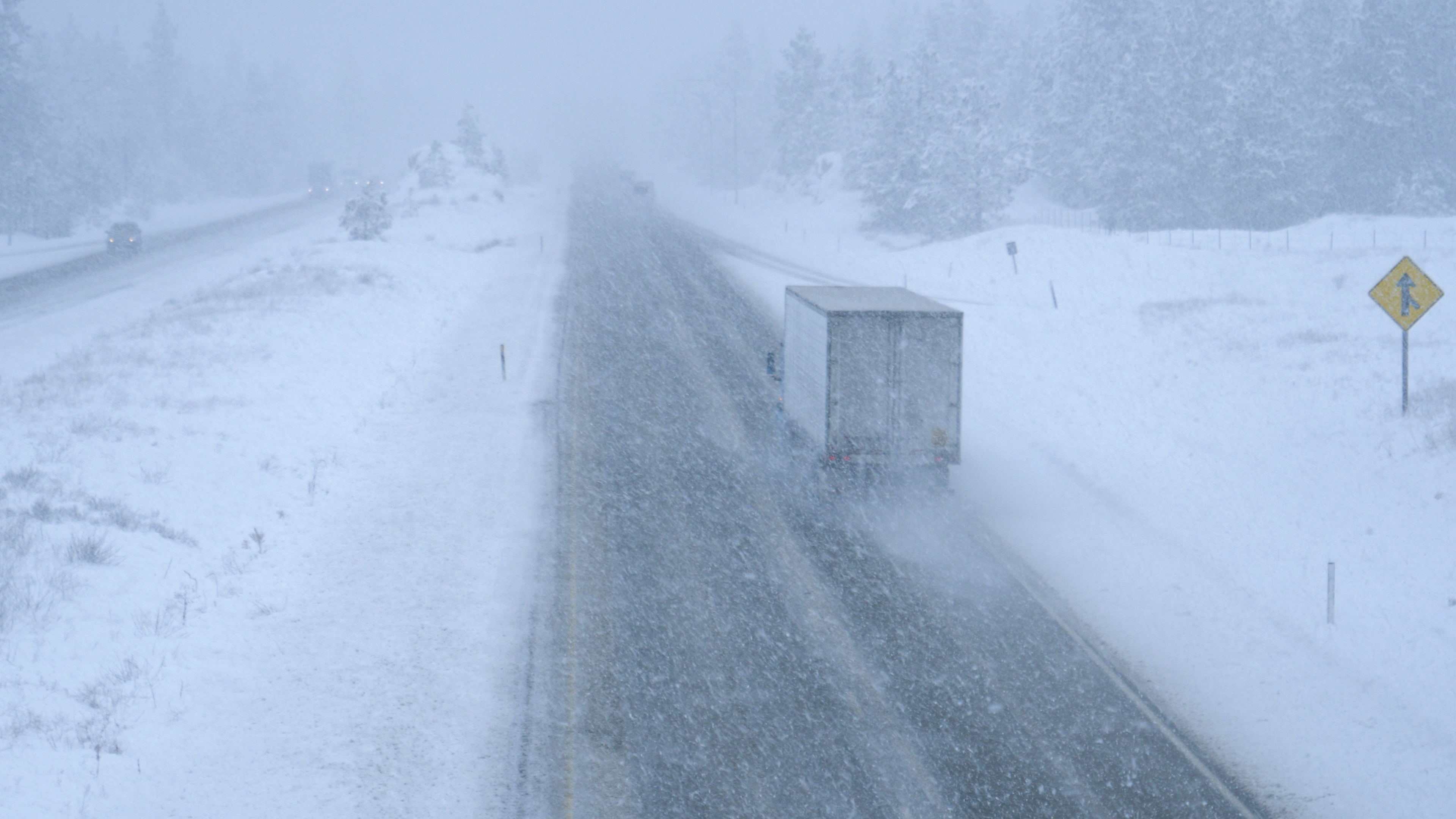
In Montana, advisories issued by the NWS offices in Great Falls and Missoula cover a wide swath of mountainous terrain, including the Gallatin and Madison County Mountains, the Centennial Mountains, and portions of Glacier National Park. Forecasters say snow will develop Saturday evening and persist into Sunday, with total accumulations generally ranging from 3 to 7 inches in the higher elevations. Winds gusting up to 40 mph are expected to accompany the snowfall, raising concerns about reduced visibility and worsening travel conditions.
The heaviest impacts in southwest Montana are expected between 5 p.m. Saturday and 6 a.m. Sunday, when snow levels rapidly fall following showers and isolated thunderstorms earlier in the day. Officials warned that roads may become slushy and slick, particularly in mountain passes such as Targhee Pass and Raynolds Pass, while backcountry conditions are likely to turn “raw” and potentially hazardous.
Further north, in the higher terrain of Glacier National Park and surrounding regions, another advisory calls for 2 to 6 inches of snow above 5,000 feet from late Saturday night through Sunday night. Slushy accumulations are also possible along mountain routes such as Marias Pass, with cold, wet and breezy weather creating a heightened risk of hypothermia for outdoor recreationists.
Additional advisories extend into western Montana’s Bitterroot and Sapphire Mountains, including travel routes around Homestake Pass, MacDonald Pass and Georgetown Lake. In those areas, similar snow totals of 2 to 6 inches are expected at higher elevations, alongside wind gusts approaching 35 mph. Authorities are urging travelers to use caution and prepare for winter-like conditions despite the mid-May timing.
Washington Winter Weather Advisory: 6 Inches of Snow to Hit
The late-season system is not confined to Montana. In Washington state, the NWS has issued winter weather advisories across the Cascades and Olympic Mountains, including popular travel corridors such as Stevens Pass and Snoqualmie Pass.
Forecasters say between 4 and 6 inches of snow could accumulate above 4,000 feet through the weekend, with higher totals possible at the highest elevations. A separate advisory for Stevens Pass warns of moderate to heavy snow showers Friday night into Saturday morning, with similar accumulation totals expected and travel disruptions likely.
The broader advisory for western Washington remains in effect through early Sunday, covering areas from Whatcom and Skagit counties south through King, Pierce and Lewis counties. Snow showers are expected to intensify at times on Friday and Saturday afternoons, with the potential for lightning and small hail embedded within the system.
While warmer ground temperatures may limit widespread accumulation on major roadways, forecasters caution that temporary snow-covered roads are still possible during heavier bursts of snowfall. The greatest impacts are expected in mountainous terrain, where recreationists, hikers and travelers could encounter rapidly changing conditions.
Meteorologists say such late-season snowfall events, while less common at lower elevations, are not unusual in the higher terrain of the West. Cold air dipping southward combined with incoming moisture can create conditions favorable for snow even in late spring, particularly at elevations above 4,000 to 5,000 feet.
Late-Season Winter Storm: What Happens Next
Officials in both states are urging residents and visitors to monitor forecasts closely and prepare for winter conditions in the mountains. Drivers are advised to slow down and check road conditions before traveling, while those heading into the backcountry should carry waterproof layers, thermal gear and emergency supplies.
The system is expected to gradually weaken by late Sunday, but forecasters warn that conditions could remain unsettled through the weekend, with lingering showers and below-average temperatures across much of the region.
Related Articles