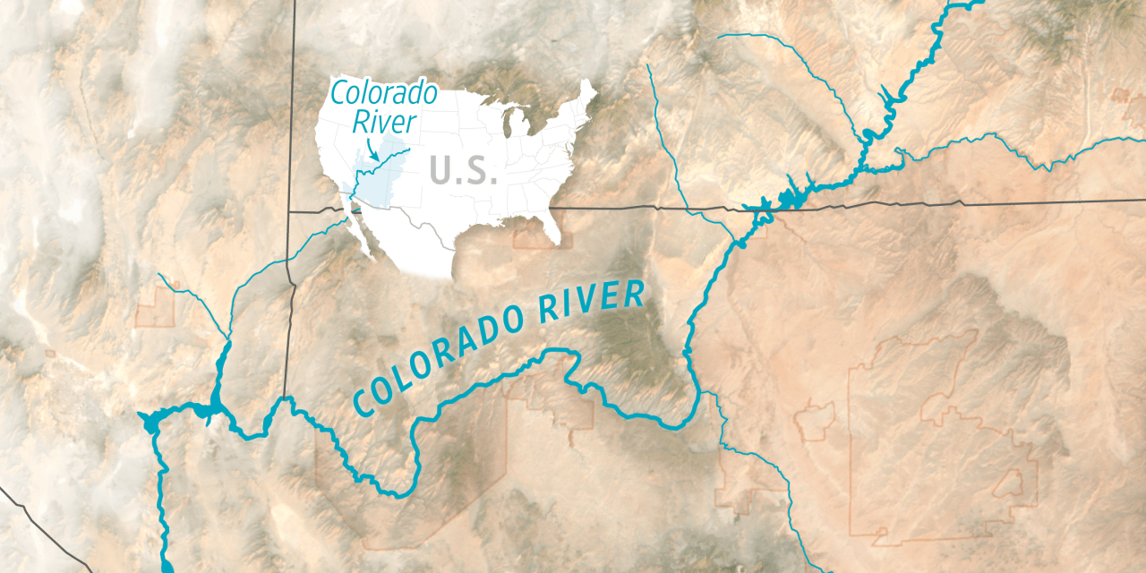
The Colorado River is running dangerously low, and the seven Western states that rely on it can’t agree on how to share what’s left.
A deal deadline came and went in February, leading the federal government to threaten its own solution—one that would keep the dams generating power, but likely bring painful cuts to water use. “We’re positive about one thing—no one will be satisfied,” Interior Secretary Doug Burgum said last month.
The river provides water for 40 million people and more than 5 million acres of farmland. Its dams produce electricity for millions of people.
The current crisis is rooted in a compact Western states made in 1922. Officials overestimated how much water the river would provide. By the 21st century, as drought gripped the region, it became harder to meet the deal’s water-allocation obligations. The diminished water supply, coupled with a growing population, has led to years of shortfalls.
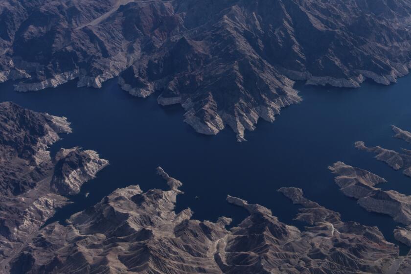
To make up for shortfalls, states pull water from the reservoirs, which serve as storage banks for the system. Drawing down reserves has taken a toll. Lakes Mead and Powell, the biggest reservoirs in the basin, have fallen about 75% from peak volumes.
The water shortages have inflamed tensions between the upper basin states: Colorado, Utah, Wyoming and New Mexico, and the lower basin states: Arizona, California and Nevada. The 1922 agreement granted roughly equal allotments from the river. But the lower basin routinely uses more.
The upper and lower basins are jockeying to shape a new, long-term solution, as several water-sharing pacts expire this year.
The unusually warm winter led to this being the worst year for snowpack in Colorado and Utah on record, according to monitoring agencies. Officials estimate Lake Powell will receive the least amount of water this year since the reservoir began to fill in 1963. “So really, just no good news,” said hydrologist Cody Moser of Colorado Basin River Forecast Center.
For now, authorities are sending water from an upstream reservoir to replenish Lake Powell, but it is a short-term fix. “There’s not enough water to fill the hole,” said Brian Richter, president of Sustainable Waters, a global water-education organization.
Top map is a composite of satellite images from Landsat taken March through September, 2020 to 2026; Lincoln Institute of Land Policy (canals, rivers)
Write to Carl Churchill at carl.churchill@wsj.com and Josh Ulick at josh.ulick@wsj.com