Two weeks ago, it reached 90 degrees in the nation’s capital. This week, the highest temperature was 70. And during the first few days of May, it will dip even lower, topping out around 60.
Despite the calendar reaching deeper into spring — which typically coincides with warmer conditions — the weather will be going in the opposite direction during the first half of May.
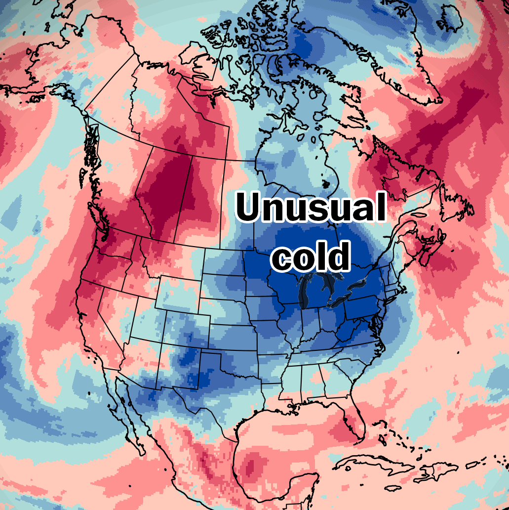
Air from Canada will chill the eastern two-thirds of the United States at times, transported into the U.S. by a particularly wavy jet stream pattern — causing late-season freezes that could damage or kill sensitive vegetation following an unusually early spring bloom.
“Frost could kill sensitive outdoor vegetation if left unprotected,” wrote the National Weather Service in Buffalo. The office in Twin Cities, Minnesota, added that these conditions could also “possibly damage unprotected outdoor plumbing.”
This cold interlude also follows the warmest March on record for the contiguous U.S., which was also the most anomalously warm month on record overall, according to temperature data analyzed by The Washington Post. This April was the third warmest on record for the country, the data also shows.
One wave of unseasonably cold air will cause freezes across the Midwest, parts of the Plains, Rockies and interior Northeast and New England on Saturday morning. That chill will expand to the Appalachians on Sunday morning, affecting about 17 million people into early next week.
After a brief warmup, an even stronger shot of chilly air later next week into next weekend will affect many of the same places.
That second cold pulse could bring widespread freezing temperatures to many Northern states, as well as the potential for scattered wet snow — made harsher by blustery winds.
For some places, it will feel more like March.
While this cold is hitting the East, rounds of record warmth are possible in the Northwest, with Portland, Oregon, forecast to reach 87 degrees on Sunday. That warmth will also extend into British Columbia and Alberta in Canada.
The second half of May doesn’t look as cold as the first half in the East, but an abrupt swing to summerlike warmth looks unlikely.
Average temperatures were about 3 degrees above average across the contiguous U.S. during April, preliminarily making it the third-warmest April on record since at least 1981.
It was particularly warm across parts of the Plains, Midwest, Mid-South, Appalachians, Southeast and Mid-Atlantic, where temperatures were 5 to 10 degrees above April averages.
While very warm conditions could return to the West during May, the chances for record warmth will fade in the East as chilly air returns.
Most Read From The Washington Post
- House passes DHS funding bill that would end shutdown for most of agency
- Trump said Iran’s oil pipelines will soon ‘explode.’ Energy experts doubt it.
- Economy picked up in early 2026, but inflation jumped, too
- How Trump’s attacks on the Fed backfired, frustrating his plans to reshape it
- Powell will remain on Fed board after term as chair ends, denying Trump a vacancy