Storm Continues Through Tuesday
The Pacific system that pounded the coast this weekend is not finished. Heading into Monday, the National Weather Service in Anchorage confirms the original storm is still spinning, while a second cyclone closes in from the west. Forecasters expect another 24 to 48 hours of mountain snow, heavy coastal rain, and gusty winds.
In the discussion issued at 4:11 PM AKDT Sunday, forecasters describe "a large, negatively tilted upper level low" continuing to rotate across the Southwest. A separate marine forecast for Valdez adds the new piece: "A front extending from a 982 mb Bering Sea low 35 nautical miles northeast of Saint George Island will move into the southwestern Gulf of Alaska Tuesday afternoon."
By Monday, the two systems will "begin to interact, spiraling around and inwards towards each other in what's called the Fujiwhara Effect," per the same NWS discussion. The combined low will be centered over the Pribilof Islands by Tuesday afternoon, pushing the worst weather toward Kodiak and the southern Alaska Peninsula.
What to Expect
- Wind gusts: 40 mph in Kodiak Island Monday night, 30 mph along Turnagain Arm on Tuesday, 25 mph in Whittier and Valdez
- Snow: Wet snow possible in Anchorage and Mat-Su before precipitation clears overnight; rain switching to all snow in Valdez after 10 PM Tuesday; continuing blowing snow on the Arctic Coast
- Mixed precipitation: Rain and snow across Southcentral Alaska, with isolated graupel reported in the Southwest Interior
- Road icing: Wet snow may refreeze overnight in Southcentral, with black ice possible on Anchorage, Mat-Su, and Turnagain Arm roads early Monday
A Winter Weather Advisory remains in effect for Point Lay on the Arctic Coast, where blowing snow has reduced visibility to a half mile or less.
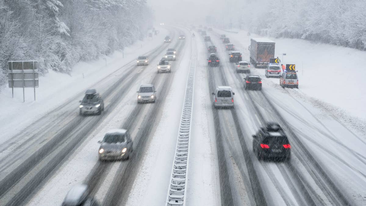
Driving Safely Through the Storm
Drivers face wet snow in the mountains, 40 mph crosswinds along the coast, and overnight refreeze on Southcentral roads. The hazards vary by location, so does the response.
For snow and ice, use 3PMSF rated winter tires with tread depth of at least 4/32 inch. Increase following distance significantly on snow covered roads, and be especially cautious on predawn ice around Anchorage and Mat-Su as wet snow refreezes. Conditions can shift between rain, slush, and packed snow within a few miles on the Seward Highway and through Turnagain Arm.
For high winds, expect a noticeable push on trucks, SUVs, and other high profile vehicles at 40 mph, particularly on exposed coastal segments around Kodiak. Slow well below posted limits, keep both hands on the wheel, and avoid cruise control when traction is compromised.
EV drivers should plan for reduced range. AAA testing has found that cold weather can cut EV range by an average of nearly 40 percent due to slower battery chemistry and energy spent on cabin heat. Preconditioning the car while plugged in and using seat heaters instead of full cabin heat helps recover some of that range.
For vehicle setup, Autoblog's guide to the best cars and SUVs for snow and winter driving covers all wheel drive systems, snow modes, and cold weather usability. EV owners can find more cold weather tactics in how to get the most range from your EV when the temperature drops. Pack a winter emergency kit per NWS winter weather safety guidance, and check the Alaska DOT 511 system for current road conditions.
What's Next
NWS forecasters expect a second wave to track toward the northern Gulf and Alaska Peninsula later this week, bringing more precipitation Friday and Saturday. Heavy mountain snow is expected through the latter half of the week, with significant accumulations likely in favored terrain into the weekend. We'll update this article as conditions evolve.