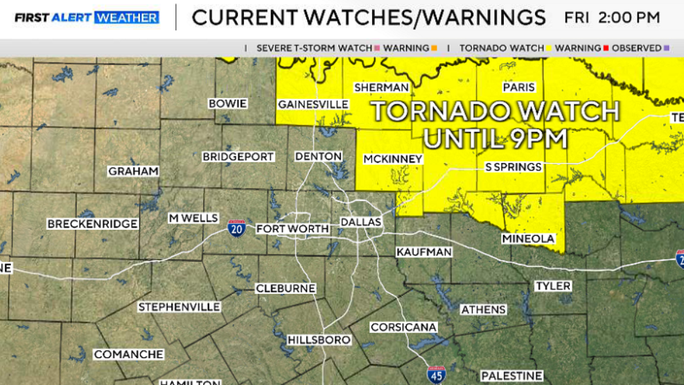
A tornado warning was in effect for parts of North Texas until 9:30 p.m. Friday as conditions have become favorable for severe weather.
At 9:15 p.m., the tornado warning for northeastern Hopkins, northeastern Delta, and southeastern Lamar counties expired.
At 9:06 p.m., a severe thunderstorm warning was issued until 10 p.m. for northeastern Hunt, central Hopkins, Delta, and southern Lamar counties in North Texas.
At 8:53 p.m., a tornado warning was issued until 9:30 p.m. for northeastern Hopkins, northeastern Delta, and south‑central Lamar counties in North Texas.
At 8:46 p.m., a severe thunderstorm warning remained in effect until 9:15 p.m. for northeastern Delta and southern Lamar counties, with storms producing tennis‑ball‑size hail and 60 mph winds.
At 8:27 p.m., a tornado warning was issued until 9:15 p.m. for northeastern Hopkins, northeastern Delta, and southeastern Lamar counties.
At 7:48 p.m., the tornado watch remained in effect for Delta, Fannin, Hopkins, Hunt, Lamar, and Rains counties. It was canceled for Collin, Cooke, Grayson, and Rockwall counties.
At 7:36 p.m., a severe thunderstorm warning was issued for central Lamar County until 8:30 p.m.
Storms were expected to develop along the I‑35 and I‑20 corridors between 5 and 6 p.m. before moving east. As the storms progress, the greatest risk for severe weather shifted toward the Highway 271 corridor, where the threat peaked around sunset, between 8 and 9 p.m.
Large hail, damaging wind gusts, and heavy rainfall capable of causing localized flooding were the primary concerns.
Residents were urged to closely monitor conditions, have multiple ways to receive weather alerts, and be ready to take shelter quickly if warnings are issued.
Friday is off to a breezy and mild start, with temperatures in the 70s areawide. Partly cloudy skies will close out the workweek, along with a CAP in place for storms.
A boundary will push as far south as DFW, and as it does this, it may erode some of the CAP and provide some fuel for an isolated storm or two to develop. Wind and hail will be the two main threats, along with a non-zero tornado threat.
The best chances for storms later Friday will still be to the northeast.
Looking ahead to the weekend, there's a 20-30% chance of storms, but any storms that develop have the potential to be severe.
Level 1 and 2 risks are in place for this weekend, with wind and hail being the two main threats, with any storms that do fire up east of a dryline sitting out to our west.
Saturday looks to be the best chance for any storm to enter the metroplex later in the day.
A higher resolution model has consistently shown storm chances Saturday afternoon into the early evening across North Texas.
Also, temperatures are expected to be in the upper 80s to near 90° this weekend, with muggy conditions both days.
Monday, temperatures will be mostly in the 90s, with a break from any storm activity until Tuesday.